We Will Conquer the Entire World!

Status
Not open for further replies.
[Info] Countries and Dependencies (March 1946)
Countries and Dependencies
March 1946
Previous Lists: May 1944, January 1945, June 1945.


Neutral Countries

The Empire
(at war with Japan, ceasefire with the UN)
  • Empire of the Romans (federation)
  • Empire of Africa (to be federalized)
  • Russian Empire (federation; including liberated areas in the Russian Far-East)
  • South Africa (federation)
  • Madagascar
  • Occupied areas in western China and western Mongolia.

Empire of Japan (at war with the UN and with the Empire)
  • Colonies: Korea, Malaya, Kamchatka, Papua.
  • Puppet States: Manchuria, Buryatia, China, the Philippines, Vietnam, Cambodia, Burma, Indonesia.
  • Thailand
  • Mongolia

India (federation)
  • Tibet

Nordic Union (confederation)
  • Norway
  • Sweden
  • Denmark
  • Finland
  • Iceland

United Kingdom
  • Isle of Man (Crown Dependency)

Ireland


United Nations

United States of America
(federation)
  • Territories: Alaska, Hawaii, Micronesia, American Samoa, US Antarctic Territory, Panama Canal Zone, Bahamas, Puerto Rico, Jamaica, Trinidad, US Caribbean.
  • Several Latin American countries may be considered Client States of the USA.

Canada (federation)
  • External Territories: Bermuda.

Australia (federation)
  • External Territories: Papua, Australian Oceania, Australian Indian Ocean Territory, Australian Antarctic Territory.

New Zealand
  • External Territories: Polynesia, New Zealand Antarctic Territory.

Latin American Countries
  • Argentina (federation; including Argentine Antarctica)
  • Bolivia
  • Brazil (federation)
  • Chile (including Chilean Antarctica)
  • Colombia
  • Costa Rica
  • Cuba
  • Dominican Republic
  • Ecuador
  • El Salvador
  • Guatemala
  • Haiti
  • Honduras
  • Mexico (federation)
  • Nicaragua
  • Panama
  • Peru
  • Uruguay
  • Venezuela (federation)
.
 
Last edited:
[Map] March 1946
Romania in the Old World
March 1946
After the Ceasefire with the United Nations
Previous maps from this series: May 1944, September 1944, January 1945, May 1945.


Area: 64,710,000 km² (43.5% of the World land area)
Population: 773 million (33% of the World population)
including:
Empire of the Romans: 28,532,000 km², 573 million
Empire of Africa: 14,446,000 km², 91 million
Russian Empire: 15,803,000 km², 84 million
South Africa: 3,392,000 km², 18 million
Madagascar: 587,000 km², 3.5 million
Occupied areas in East Asia: 1,948,000 km², 3.5 million​


Open image in new tab to view map at full resolution.

Beware of the significant area distortion at the higher latitudes, inherent to the Mercator map projection used by Google Maps.

For details about the status of various territories, please see the list of
Countries and Dependencies (March 1946).


Key:
1. Denmark (Nordic Union)
2. Sweden (Nordic Union)
3. Latvia (Empire of the Romans)
4. Northern Russia (Russian Empire)
5. Tunisia (Empire of the Romans)
.
 
Last edited:
[Info] The Empire (April 1946), I
Previous Infochapters from this series:


The Empire
Imperiul, Imperium

April 1946


Official Name: The Empire of the Romans (Imperiul Romanilor, Imperium Romanorum).

Common Names: Romania (România), the Roman Empire (Imperiul Roman, Imperium Romanum).


Official Flag:


The Imperial Purple (Tyrian Purple).


Commonly Used Flag:


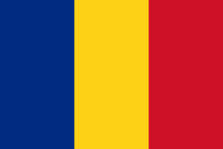
The Romanian Tricolour


Motto: In varietate concordia (Latin, Unity in diversity).


Official Emblem (Coat of Arms):


The Roman Fasces


Anthem: The Imperial March (Marșul Imperial).


National Day: 10 May (the Unification of the Realms, 1940).


Map: Link to map post.


Capital: Constantinople (2.1 million), 41°01′N 28°57′E
Largest city: Paris (5.6 million), 48°51′N 2°21′E

Demonym: Roman (Romanum, commonly used: Imperial, Romanian).


Official Languages: Romanian, Modern Latin (Roman), Hungarian, Bulgarian, Slovak, Ukrainian, German, Serbo-Croatian, Greek, Turkish, Kurdish, Arabic, Yiddish, Hebrew, Armenian, Georgian, Azeri, Russian, Turkmen, Persian, Pashto, Uzbek, Tajik, Kyrgyz, Kazakh, Albanian, Uyghur, Italian, Amharic, Tigrinya, Oromo, Somali, Berber, Slovene, Polish, Belarussian, Lithuanian, Latvian, Estonian, French, Dutch, Catalan, Castilian, Portuguese, others.

Minority Languages: See the Imperial States entries.

Religions: Imperial Christianity, Protestantism, Islam, Judaism, Buddhism, others, non-religion.


Government: Imperial Dictatorship / Absolute Monarchy, Federal Empire.

Head of State: Empress Anne Julia (Împărăteasa Ana Iulia, Anna Iulia Imperatrix).
Heir: Imperial Crown Princess Victoria Augusta Porphyrogenita.

Head of Government (Prime Minister): Vacant (powers exercised by the Empress).

Legislature: Imperial Senate (advisory role).


Establishment history:
Unification of the Realms: 10 May 1940 (Romania, Bulgaria, Hungary, Slovakia, Ruthenia, Serbia) -- 6 States.
First Enlargement: 6 September 1940 (Croatia, Greece) -- 8 States.
Proclamation of the Empire: 18 September 1940.
Second Enlargement: 10 May 1941 (Turkey) -- 9 States.
Third Enlargement: 28 May 1941 (Kurdistan) -- 10 States.
Formation of the Capital District: 29 May 1941.
Fourth Enlargement: 14 July 1941 (Syria, Iraq) -- 12 States.
Fifth Enlargement: 18 October 1941 (Armenia, Georgia, Azerbaijan, Holy Land) -- 16 States.
Sixth Enlargement: 22 July 1942 (Cossackia) -- 17 States.
Seventh Enlargement: 1 December 1943 (Turkmenistan) -- 18 States.
Eighth Enlargement: 22 December 1943 (Hejaz, Nejd) -- 20 States.
Ninth Enlargement: 15 January 1944 (Afghanistan) -- 21 States.
Tenth Enlargement: 27 February 1944 (Yemen, Oman, Iran) -- 24 States.
Eleventh Enlargement: 10 May 1944 (Uzbekistan, Tajikistan, Kyrgyzstan, Kazakhstan) - 28 States.
Twelfth Enlargement: 29 May 1944 (Egypt) - 29 States.
Thirteenth Enlargement: 6 September 1944 (Albania) -- 30 States.
Fourteenth Enlargement: 20 October 1944 (Ethiopia, Libya) - 32 States.
Fifteenth Enlargement: 1 December 1944 (East Turkestan, Somalia) -- 34 States.
Sixteenth Enlargement: 10 March 1945 (Slovenia, Poland, Belarus, Dagestan, Kalmykia) -- 39 States.
Seventeenth Enlargement: 10 May 1945 (Lithuania, Latvia, Estonia; enlarged Ruthenia split into Western Ukraine and Eastern Ukraine) - 43 States.
Eighteenth Enlargement: 25 December 1945 (Tunisia, Algeria, Berberia) -- 46 States.
Nineteenth Enlargement: 1 March 1946 (Northern Italy, Southern Italy, Insular Italy, Western France, Eastern France, Southern France, Netherlands, Switzerland, Western Germany, Southern Germany, Prussian Germany, Austrian Germany, Catalonia, Castile, Portugal, Basque Country, Macaronesia, Morocco, Western Indian Ocean Islands) -- 65 States.


Area: 28,532,000 km² (11,016,000 sqmi), 1st place.
Including indirectly controlled areas: 64,710,000 km² (24,985,000 sqmi).


Population: 573 million, 1st place.
Density: 20.08/km² (52.02/sqmi).
Including indirectly controlled areas: 773 million; 11.95/km² (30.94/sqmi).


Administrative Divisions: 1 Capital District, 65 Federal States, 8 Special Regions, 116 Autonomous Regions, 1302 Counties.
Client States: the Empire of Africa, the Russian Empire, South Africa.
Puppet State: Madagascar.
For details, see below.


Miscellanious
Currency: 1 Leu = 100 Bani (with regional coins and banknotes translated into the official languages of the Federal States).
Time Zone: de jure Imperial Time (GMT+2), de facto between GMT and GMT+12.
Drives on the right.


Imperial States
April 1946

  1. Romania
  2. Bulgaria
  3. Hungary
  4. Slovakia
  5. Western Ukraine
  6. Serbia
  7. Croatia
  8. Greece
  9. Turkey
  10. Kurdistan
  11. Syria
  12. Iraq
  13. Armenia
  14. Georgia
  15. Azerbaijan
  16. Holy Land
  17. Cossackia
  18. Turkmenistan
  19. Hejaz
  20. Nejd
  21. Afghanistan
  22. Yemen
  23. Oman
  24. Iran
  25. Uzbekistan
  26. Tajikistan
  27. Kyrgyzstan
  28. Kazakhstan
  29. Egypt
  30. Albania
  31. Ethiopia
  32. Libya
  33. East Turkestan
  34. Somalia
  35. Slovenia
  36. Poland
  37. Belarus
  38. Dagestan
  39. Kalmykia
  40. Lithuania
  41. Latvia
  42. Estonia
  43. Eastern Ukraine
  44. Tunisia
  45. Algeria
  46. Berberia
  47. Northern Italy
  48. Southern Italy
  49. Insular Italy
  50. Western France
  51. Eastern France
  52. Southern France
  53. Netherlands
  54. Switzerland
  55. Western Germany
  56. Southern Germany
  57. Prussian Germany
  58. Austrian Germany
  59. Catalonia
  60. Castile / Spain
  61. Portugal
  62. Basque Country
  63. Macaronesia
  64. Morocco
  65. Western Indian Ocean Islands

For details about the older Imperial States, please see: First list of states, Second list of states, Third list of states, Fourth list of states.


44. Tunisia
تونس / Tūnis


Capital: Tunis (تونس‎).

Official Languages: Arabic.

Minority Languages: Berber, French, Italian.

Religions: Sunni Islam, Imperial Christianity, Judaism.

Ruler: King Muhammad VIII al-Amin (الأمين باي بن محمد الحبيب).

Statehood: 25 December 1945.

Administrative Divisions: 6 Counties.


45. Algeria
الجزائر / Al-Jazā'ir
Algérie


Capital: Algiers (Al-Jazāʾir / الجزائر‎, Alger).

Official Languages: Arabic, French.

Minority Languages: Berber.

Religions: Sunni Islam, Imperial Christianity, Judaism.

Ruler: Military rule.

Statehood: 25 December 1945.

Administrative Divisions: 5 Counties.


46. Berberia
ⵜⴰⵎⴰⵣⵖⴰ / Tamazɣa
Berbèrie
تامازغا / Tamazgha


Capital: Tamanrasset (Tamenɣast / ⵜⵎⵏⵗⵙⵜ, Tamnghast / تمنغاست).

Official Languages: Berber, French, Arabic.

Minority Languages: None.

Religions: Sunni Islam.

Ruler: Military rule.

Statehood: 25 December 1945.

Administrative Divisions: 6 Counties.


Italy
Italia


Official Languages: Italian.

Religions: Imperial Christianity.

Ruler: Queen Mafalda (Mafalda di Savoia).

Statehood: 1 March 1946.


47. Northern Italy
Italia Settentrionale

Capital: Milan (Milano).

Minority Languages: French, German, Friulian, Slovene.

Administrative Divisions: 5 Autonomous Regions (Aosta, Valtellina, South Tyrol, Istria, San Marino), 12 Counties.


48. Southern Italy
Italia Meridionale

Capital: Rome (Roma).

Minority Languages: Albanian, Greek.

Administrative Divisions: 1 Special Region (Vatican City), 10 Counties.


49. Insular Italy
Italia Insulare

Capital: Cagliari.

Minority Languages: French, Sardinian, Maltese, Greek.

Administrative Divisions: 4 Autonomous Regions (Corsica, Sardinia, Sicily, Malta), 4 Counties.


France
France


Official Languages: French.

Religions: Imperial Christianity.

Ruler: King Henry VI (d'Orléans).

Statehood: 1 March 1946.


50. Western France
France Occidentale

Capital: Paris.

Minority Languages: Breton.

Administrative Divisions: 3 Autonomous Regions (Brittany, Guernsey, Jersey), 30 Counties.


51. Eastern France
France Orientale

Capital: Lyon.

Minority Languages: Dutch.

Administrative Divisions: 2 Autonomous Regions (French Flanders, Wallonia), 32 Counties.


52. Southern France
France Méridionale

Capital: Marseille.

Minority Languages: Occitan.

Administrative Divisions: 1 Autonomous Region (Monaco), 32 Counties.


53. Netherlands
Nederland


Capital: Amsterdam.

Official Languages: Dutch.

Minority Languages: French, Frisian.

Religions: Imperial Christianity, Protestantism.

Ruler: Queen Juliana.

Statehood: 1 March 1946.

Administrative Divisions: 1 Autonomous Region (Brussels), 18 Counties.


54. Switzerland
Schweiz
Suisse
Svizzera


Capital: Bern.

Official Languages: German, French, Italian.

Minority Languages: Romansh.

Religions: Imperial Christianity, Protestantism.

Ruler: Federal Council.

Statehood: 1 March 1946.

Administrative Divisions: 24 Counties (Cantons, all autonomous).


Germany
Deutsches Reich / Deutschland


Official Languages: German.

Religions: Imperial Christianity, Protestantism.

Ruler: Kaiser Wilhelm IV.

Statehood: 1 March 1946.


55. Western Germany
Westdeutschland

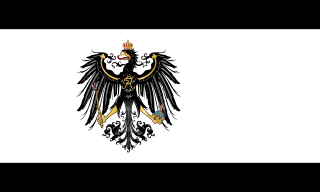
(alongside the national flag)

Capital: Frankfurt.

Minority Languages: Frisian.

Administrative Divisions: 16 Counties.


56. Southern Germany
Süddeutschland

(alongside the national flag)

Capital: Munich (München).

Minority Languages: French.

Administrative Divisions: 2 Autonomous Regions (Luxembourg, Alsace-Lorraine), 10 Counties.


57. Prussian Germany
Preußisches Deutschland / Preußen

(alongside the national flag)

Capital: Berlin.

Minority Languages: Polish, Lithuanian.

Administrative Divisions: 1 Autonomous Region (Posen), 9 Counties.


58. Austrian Germany
Österreichisches Deutschland / Österreich

(alongside the national flag)

Capital: Vienna (Wien).

Minority Languages: Czech, Slovene.

Administrative Divisions: 1 Autonomous Region (Czechia), 13 Counties.

.
 
[Info] The Empire (April 1946), II
Imperial States
April 1946
Continued


59. Catalonia (Catalan Hispania)
Catalunya
Cataluña


Capital: Barcelona.

Official Languages: Catalan, Castilian.

Minority Languages: French.

Religions: Imperial Christianity.

Ruler: King Miquel I (of Bourbon-Parma, Anne's brother).

Statehood: 1 March 1946.

Administrative Divisions: 3 Autonomous Regions (Andorra, Roussillon, Balearic Islands), 12 Counties.


60. Castile / Spain (Castilian Hispania)
Castilla / España


Capital: Madrid.

Official Languages: Castilian.

Minority Languages: None.

Religions: Imperial Christianity.

Ruler: King Juan Carlos I (the father of OTL Juan Carlos I).

Statehood: 1 March 1946.

Administrative Divisions: 33 Counties.


61. Portugal (Portuguese Hispania)
Portugal


Capital: Lisbon (Lisboa).

Official Languages: Portuguese.

Minority Languages: Castilian.

Religions: Imperial Christianity.

Ruler: King Duarte I.

Statehood: 1 March 1946.

Administrative Divisions: 1 Autonomous Region (Galicia), 16 Counties.


62. Basque Country (Basque Hispania?)
Euskal Herria
País Vasco
Pays Basque


Capital: Bilbao (Bilbo).

Official Languages: Basque, Castilian, French.

Minority Languages: None.

Religions: Imperial Christianity.

Ruler: President José Antonio Aguirre.

Statehood: 1 March 1946.

Administrative Divisions: 2 Autonomous Regions (Navarre, Iparralde), 8 Counties.


63. Macaronesia (Insular Hispania?)
Macaronésia
Macaronesia


Capital: Las Palmas.

Official Languages: Castilian, Portuguese.

Minority Languages: None.

Religions: Imperial Christianity.

Ruler: Direct rule from Constantinople.

Statehood: 1 March 1946.

Administrative Divisions: 1 Special Region (Saint Helena, Ascension and Tristan da Cunha), 4 Autonomous Regions (Azores, Madeira, Canary Islands, Cape Verde), 5 Counties.


64. Morocco
المغرب‎ / Al-Maḡrib
ⵍⵎⵖⵔⵉⴱ / lmeɣrib


Capital: Fes (فاس‎ / fās).

Official Languages: Arabic, Berber.

Minority Languages: Castilian, French.

Religions: Sunni Islam.

Ruler: King Mohammed V.

Statehood: 1 March 1946.

Administrative Divisions: 16 Counties.


65. Western Indian Ocean Islands
Western Indian Ocean Islands
Îles de l'Océan Indien Occidental


Capital: Port Louis.

Official Languages: English, French.

Minority Languages: Various.

Religions: Imperial Christianity, Sunni Islam, Hinduism, Buddhism.

Ruler: Direct rule from Constantinople.

Statehood: 1 March 1946.

Administrative Divisions: 6 Autonomous Regions (Comoros, Seychelles, Bourbon, Mauritius, Rodrigues, Chagos), 9 Counties.


Client States of the Empire
April 1946


Empire of Africa
Imperiul African
Empire d'Afrique
Império da África
Empire of Africa


Capital: Congoville.

Demonym: African.

Official Languages: Romanian, French, Portuguese, English.

Minority Languages: African Languages.

Religions: Imperial Christianity, Sunni Islam, Protestantism, Animism.

Ruler: Empress Anne.
Prime Minister: Makumba Mutombo.

Area: 14,446,000 km² (5,578,000 sqmi).

Population: 91 million.
Density: 6.30/km² (14.48/sqmi).

Administrative Divisions: To be created (Federal States).


Russian Empire
Российская Империя / Rossiyskaya Imperiya

(Imperial flag)

(National flag)

Capital: Moscow (Москва / Moskva).

Demonym: Russian.

Official Languages: Russian.

Minority Languages: Various.

Religions: Imperial Christianity, Sunni Islam, Judaism, Buddhism, Animism.

Ruler: Tsar Vladimir I (Влади́мир Кири́ллович Рома́нов / Vladimir Kirillovich Romanov).

Area: 15,803,000 km² (6,102,000 sqmi).

Population: 84 million.
Density: 5.32/km² (13.77/sqmi).

Administrative Divisions: 5 Kingdoms (Northern Russia, Western Russia, Central Russia, Siberian Russia, Far-Eastern Russia), 3 Grand Duchies (Yakutia, Tuva, Buryatia), 62 Oblasts (9 of them Autonomous), 9 Autonomous Okrugs.


South Africa
South Africa
Zuid-Afrika
Südafrika
África do Sul


Capitals: Pretoria, Cape Town, Bloemfontein.

Demonym: South African.

Official Languages: English, Dutch, German, Portuguese.

Minority Languages: African Languages.

Religions: Protestantism, Imperial Christianity, Animism.

Ruler: Prime Minister Jan Smuts.

Area: 3,392,000 km² (1,310,000 sqmi).

Population: 18 million.
Density: 5.31/km² (13.74/sqmi).

Administrative Divisions: 7 Federal States (Cape, Orange, Natal, Transvaal, Namibia, Rhodesia, Mozambique), 3 Indigenous Areas (Bechuanaland, Basutoland, Swaziland).


Madagascar
Madagasikara
Madagascar


Capital: Tananarive (Antananarivo).

Demonym: Malagasy.

Official Languages: Malagasy, French.

Minority Languages: None.

Religions: Protestantism, Imperial Christianity, Animism.

Ruler: Military rule.

Area: 587,000 km² (227,000 sqmi).

Population: 3.6 million.
Density: 6.13/km² (15.88/sqmi).

Administrative Divisions: 6 Provinces.

.
 
Last edited:
Chapter 93. India
Chapter 93. India


March 1946, the Empire


Nuclear scientist Stanisław Ulam discussed with the Empress his team's scientific breakthroughs regarding nuclear fusion. The scientists estimated that the first fusion bombs, also known as hydrogen bombs, would be available in a couple of years. Compared to the classic fission devices, the hydrogen bombs presented three major advantages: much larger yields (which could be easily increased even more, with no theoretically upper limit), smaller quantities of scarce and expensive to produce fissionable isotopes (such as plutonium 239) and less radioactive fallout (depending on certain parameters).

The military estimated that at least one thousand bombs were needed for a credible nuclear deterrent. The Empress also wanted powerful bombs for various peaceful applications, such as the quick digging of canals or spaceship propulsion. The Empress also wanted to develop nuclear fusion reactors and continuously allotted significant resources to that end, despite the lack of success over the following decades.

Missile research was also promissing. While their accuracy was still difficult to improve, the effective range of the missiles was incrementally increased and the production costs were slightly lowered. It was estimated that the first intercontinental missiles would be available in the early 1950's, with spaceflight coming at about the same time.

Although not benefitting from Anne's interest (who didn't see them as particularly useful), faster, better and more reliable computers were still being build by various teams of researchers (mainly expanding upon Konrad Zuse's prototypes). However, little practical progress could be achieved while still depending on vacuum tube electronics and Oskar Heil's research in solid state transistors was still in its infancy.


Shortly before, during, or shortly after the Accession of Western Europe and the Maghreb to the Empire, the former monarchies were restored in some of the new Imperial States, while others became monarchies for the first time.

Italy was already a kingdom, ruled by Queen Mafalda I. When Italy was split into the three Italian Imperial States, they remained in personal union under Mafalda I. Her father, the former King Victor Emmanuel III, and his heir presumptive, Crown Prince Umberto, were in exile in the United States.

The Bourbon-Orleans dynasty was restored in France (after more than one century), with Henri, Count of Paris, becoming King Henry VI. When France was split into the three French Imperial States, they remained in personal union under Henry VI. The sub-national monarchy of Monaco was also restored, but with very little actual power. The Napoleonic claimant, Louis, Prince Napoléon, was in exile in the United States.

The Netherlands were already a kingdom, ruled by Queen Juliana. Her monther, the former Queen Wilhelmina, was in exile in the United States.

Switzerland remained a federal republic. The monarchy of Liechtenstein was preserved as a sub-national monarchy inside republican Switzerland (a new Swiss Canton), but the powers of the prince where drastically reduced, so Franz Joseph II continued his rule as a mere figurehead.

The Hohenzollern dynasty was restored in the German Reich, with Wilhelm, German Crown Prince, becoming Wilhelm III, German Kaiser. However, he abdicated the throne the following day in favour of his oldest son and heir, Prince Wilhelm of Prussia, who thus became Wilhelm IV, German Kaiser. When the German Reich was split into the four German Imperial States, they remained in personal union under Wilhelm IV. The sub-national German monarchies of Bavaria, Baden, Württemberg and Luxembourg were also restored, but their monarchs held very little power.

The Bourbon dynasty was restored in Spain, with Infante Juan of Spain, Count of Barcelona, becoming King Juan Carlos I. When Spain and Portugal were joined to form Hispania, Juan Carlos I became King of All Hispania, title which he held for six days, until Hispania was split into the five Hispanian Imperial States. Afterwards, Juan Carlos I remained King of Castilian Hispania, but the other Hispanian Imperial States did not want to stay in a personal union with it.

Because Catalan Hispania did not want a personal union with Castilian Hispania, another Bourbon prince ought to be found. Luckily, Anne was a Bourbon-Parma, so her younger brother, Prince Michel of Bourbon-Parma, became King Miquel I of Catalonia.

The youngest brother of the Empress, André, had lost his life in the German missile attack against Belgrade, while attending the wedding of King Peter II of Serbia. The older brother of the Empress, Jacques, had married Queen Aida Desta of Ethiopia and was living with her in Addis Abeba as the Prince Consort of Ethiopia. Queen Aida's grandfather, the former Emperor Haile Selassie, and his heir presumptive, Crown Prince Asfaw Wossen, were in exile in the United States. The marriage of a European prince to an African queen had ruffled a few feathers, but the Empire's tolerant racial policies prevented the incident from being blown out of proportion.

The Braganza dynasty was restored in Portuguese Hispania, with Duarte Nuno, Duke of Braganza, becoming King Duarte I. The former monarchical blue-white flag of Portugal was also restored, replacing the republican green-red flag.

The newly established Basque Hispania opted to be a republic.

Because of its strategic and vulnerable position, Macaronesia remained under direct rule from Constantinople for the time being. Anyway, there were no plans of turning the small state into a kingdom.

With Hispania practically stillborn for various reasons (no common sense of nationhood, no common flag, no personal union, no shared government institutions), it was officially dissolved three weeks later (remaining one of Anne's failed weird experiments). Catalan Hispania was officially renamed Catalonia, Castilian Hispania was officially renamed Castile (or Central Spain), Portuguese Hispania was officially renamed Portugal and Basque Hispania was officially renamed the Basque Country.

Tunisia was elevated to a kingdom and Bey Muhammad VIII al-Amin (Lamine Bey) became King Muhammad VIII. Later, he was also given the newly established crown of Algeria, when an informall poll clearly indicated that the Muslim majority was extremely averse to having Henry VIII as their king (in a personal union with France).

Morocco was already a kingdom, ruled by King Mohammed V. Later, he was also given the newly established crown of Berberia (part of which had been Moroccan territory before the French conquest of North Africa).

Because of its strategic position and the total lack of national unity between the islands, the Western Indian Ocean Islands Imperial State remained under direct rule from Constantinople for the time being.

The Hova dynasty was restored in Madagascar (not yet an Imperial State), with Princess Marie-Louise (the grandniece and heir of the last queen of Madagascar, Ranavalona III), becoming Queen Marie-Louise. It was still debated whether to join Madagascar to the Empire of the Romans or to the Empire of Africa. Until then, it remained a small puppet state of the Empire, with much less internal autonomy than the much larger and already long established neighbouring South Africa.

The Windsor dynasty was restored in South Africa (not yet an Imperial State), with Princess Elizabeth (British Queen in pretence), becoming Queen Elizabeth II. It was still debated whether South Africa ought to be joined to the Empire before or at the same time with the Empire of Africa (if the former, it would be a non-contiguous state).


7-26 March 1946, India

The 7th of March Imperial ultimatum provoked consternation in New Delhi, not because an Imperial aggression was unexpected but because it was expected to happen after the end of the war against Japan. The Indians had thought that the Empire would avoid a two front war and that they had another six to twelve months to improve their army and to strengthen their impressive-looking defensive works along the Indus River.

India had a very large population (almost 400 million, second only to the Empire) and a relatively large standing army of three million, to be increased by conscription to at least twelve million (hopefully). Therefore, taking into consideration the advantage of the defender on its home territory, it seemed reasonable to think that India could resist an Imperial invasion (which had about two times the population of India and a total army of sixty million men, but which could not be deployed on a single front).

However, the Indian military commanders knew that, in practice, the situation was almost desperate. Sure, the population of India was very large, but a good part of it was illiterate and very poor and the Indian economy was very weak with almost no heavy industry to speak of. Sure, India could produce rifles, ammunition, uniforms and some explosives, but almost anything else (especially tanks and aircraft) had to imported. However, importing armaments posed two problems -- India was very short of cash and nobody wanted to sell weapons anyway¹ (except obsolete models, of course).
1. Until recently, the United Nations were still fighting the Empire and, after the Oslo Ceasefire, they were reluctant to help the Empire's enemies in the Old World (which has been recognized as Imperial turf).
Japan was fighting a total war in East Asia and, even if they could spare some modern weapons (they couldn't), they had little means of transporting them to India (except overland, through the jungles of Burma).


In fact, the disproportion between the Imperial and Indian tanks and military aircraft was enormous, both in quality and in quantity. Moreover, while the Imperial population was entirely loyal to the state, India was rife with widespread religious, linguistic and tribal divides. And, while the Empire had tens of millions of battle-hardened soldiers who had fought for years, from the Equator to the Arctic Ocean and from mountains or jungles to deserts or swamps, most Indian soldiers had seen little to no actual combat and, when they had, it was usually under the command of British officers (who were now absent).

All that being considered, the Indian military knew that the only real obstacle that the Empire would face was the Indus River and the vast network of fortifications hastily built on its left bank during the two years since independence (Balochistan and Afghania were undefendable and had to be evacuated). If (or when) the Empire crossed the Indus, it could then blitz through the mostly featureless Indo-Gangetic Plain all the way to Delhi, if not to Calcutta.

Of course that the Indian government asked for support. Neither the United Kingdom, nor the United Nations were allowed to deliver any after their ceasefires with the Empire and Japan was unable to help while being pounded mercilessly in China, Mongolia and Siberia. Thailand was the only country which promissed to help, by sending up to fifty thousand soldiers and twenty-five fighter aircraft, if needed.

Of course that India could accept the Imperial ultimatum which, while humiliating, did not represent a loss of sovereignty. Bose could resign for the greater good and India could declare war to Japan and send some token forces to the Burmese border to engage in skirmishes with the Japanese defenders, mainly for show. Obviously, India did not have the offensive capabilities needed for a successful conquest of Burma (and that was not desired in the first place). Of course that the Empire was not going to simply give up and the fabrication of a new casus belli was expected in a couple of months, but that represented precious time in which India could continue its defence preparations, with the bulk of its forces still guarding the Indus.

In the end, the issue was put up to a vote in front of the Indian Security Council, which decided to accept the ultimatum (with seven votes out of thirteen). Prime Minister Bose presented his resignation to President Gandhi and India delivered a declaration of war to Japan. However, unofficially, the Indians informed the Japanese that they were acting under duress and that they had no intention to conquer Burma or to really prosecute the war in any meaningful capacity. Japan promissed to only respond to Indian aggression and to refrain from any attacks against Indian territory.


The Indians sent one hundred thousand men with obsolete weaponry to the Burmese border, but they really took their time to arrive there. In the mean time, India was mobilizing more men to reinforce the Indus and new fortifications were built along its eastern bank at a record rate. The depleted units already stationed at the north-eastern frontier opened artillery fire against the Japanese positions and advanced up to three kilometres inside Burmese territory, fighting (and badly losing) several skirmishes with the Japanese (who did not pursue).

Confronted to such a transparent ruse, Anne lost her patience in less than two weeks and the Empire sent a second ultimatum to India.

It has come to Our knowledge that the Indian Army is experiencing major difficulties in fighting the enemy in Burma. Luckily, the Empire is already well versed in fighting the Japanese and it is both ready and willing to help its Indian allies in their conquest of Burma. Therefore, the Empire demands to be granted access for its legions, to pass through Indian territory and reach the static frontlines in Burma, in order to help break the Japanse defences. Should India refuse this request, the Empire would surely understand that, under the mask of limited warfare, the Indian collusion with the enemy is, in fact, continuing. In that case, the Empire reserves its option to act accordingly, in order to protect its legitimate interests.

Without even waiting for an answer, the Imperial Army crossed the Indian border and began to march towards the Indus, encountering almost no organized resistence. Nonetheless, a few shootings did occur, but the Empire acknowledged them as friendly fire and simply asked India to adequately inform the local military commanders that the Empire had come to India as an ally and not as an enemy.

The farce came to an abrupt end when the Imperial Army reached the Indus and the Indian defenders refused to allow passage. Within hours, the tense stand-off turned into impressive barrages of artillery fire. The Empire immediately deplore[d] the treacherous attack against its erstwhile ally and declared war on India. Japan and India signed a pre-written peace treaty later that day, but stopped short of entering an alliance, preferring to fight their separate wars against the Empire (as real collaboration was all but impossible because of the Himalayas and of the huge distances invlolved).


27 March - 3 May 1946, India

The Empire asked the Dalai Lama to allow the Imperial Army to enter Tibet. The Empire promissed to maintain the Buddhist character of Tibet and the institution of the Dalai Lama, but insisted that feudalism be ended swiftly. Significant revisions of the borders with China were also promissed, to include in Tibet all the areas with Tibetan majority. After being informed that the Indians were unable to help in any meaningful way, the Dalai Lama unilaterally renounced the Indian Protection and accepted the Imperial takeover. No military resistance was offered and, five days later, when the Imperial Army reached Lhasa, the Dalai Lama peacefully surrendered Tibet to the Empire.


The Empire completed the practically unopposed conquest of Balochistan and Afghania in three more days, reaching the Indus on its entire length, with the exception of the heavily fortified area around Karachi, close to the mouth of the Indus. However, the Sindh was of secondary interest to the Empire compared to the Punjab, which opened the way to the Indo-Gangetic Plain, the rich agricultural and demographic heartland of India. Therefore, the Empire concentrated its forces on the middle course of the Indus, specifically in the segment between Multan and Rawalpindi.

Within days, the Imperial air superiority turned into virtually unopposed air supremacy, after the almost total obliteration of the small and antiquated Indian Air Force. Thereafter, the Indian positions on the left bank of the Indus were bombed continuously, not only by the longer range and very precise Imperial artillery but also by the state of the art Imperial heavy bombers which dropped their payload with almost complete impunity. The Indus fortifications, which used to be the pride of the Indian military, were quickly turned into rubble, frequently trapping the soldiers underneath the collapsing structures.

After one week of dropping an enormous amount of conventional explosives (no nuclear weapons were used in India), the Imperial Army crossed the Indus in force. The Indians had clear orders to keep the Indus line at all costs, so almost one million Indian soldiers were called to plug the gap and throw the Romans back to the right bank of the Indus. The Empire accepted the challange and engaged the Indians in a titanic battle to the north-west of Multan. The battle raged for almost five days and ended in the complete destruction of an entire Indian Army Corps and the loss of numerous Indian tanks.


The gap was thus opened large and millions of soldiers and thousands of medium and heavy Imperial tanks crossed the Indus, ready to blitzkrieg their way through the wide open Indo-Gangetic Plain. One week later, the Empire controlled both banks of the Indus from north of Rawalpindi to south of Multan and had advanced eastwards all the way to Lahore. The Punjabi capital fell on the 13th of April, after another battle which saw the destruction of most of the remaining Indian tanks and other heavy armoured vehicles.

During the second half of April, the speed of the southeastward advance of the Imperial Army was usually determined more by the fuel supply and less by the increasingly weak and disorganized Indian resistance. Of course that many Indian soldiers fought admirably, especially the elite Nepali troops called Gurkhas, but their bravery and martial prowess in close combat was useless against tanks and military aircraft.

After clearing most of Punjab and the northern part of Rajashtan, the Empire took Ajmer and the Rajashtani capital Jaipur, then entered Uttar Pradesh from the south and took Agra, threatening to encircle Delhi. With the position being deemed undefendable, the Indian Government quickly relocated to Calcutta and Delhi was declared an open city on the 25th of April.

Six days later, the Imperial Army reached the Ganges near Kanpur and destroyed another Indian Army Corps, whose remnants scattered southwards. By then, the Indian Government, the Indian Army and most of the Indian population had already realized that everything was lost and surrender was the only possible option.


In those conditions, on the 27th of April, Indian President Mahatma Gandhi asked for terms and the diplomats met in Patna the following day. Initially, the negotiations were difficult, so the Imperial Army crossed the Ganges in a last show of force and took the Uttar Pradesh capital of Lucknow, after obliterating yet another Indian Army. That proved to be the last straw and the Indian Army surrendered on the 2nd of May, followed by the Indian Government and State one day later.


5 March - 30 April 1946, East Asia and the Pacific

The Imperial Army advanced unopposed in the territory vacated by the Japanese prior to the unleashing of their biological warfare arsenal in Western China. Until the needed amounts of vaccines and medicine were produced, the worst affected area remained under strict quarantine, with only a limited number of highly trained Imperial soldiers getting in, to help the medical personnel, to distribute food, clean water and coal and to maintain law and order. With the price of millions of lives, the Japanese have reached their primary objective -- the Imperial advance eastwards was temporarily halted.


In the south, the Imperial Army reached the small, mountainous area still controlled by the Kuomintang at the border with Tibet. The Kuomintang leader and general of the National Revolutionary Army, He Yingqin, immediately surrendered to the Empire with all his troops (by then reduced to less than seven thousand men). He sent a sealed letter to Empress Anne.

You conquered most of the world in six years. You are the greatest conqueror the world has ever seen. Now you come to smite the Japanese oppressors and free China from their murderous grasp. The Mandate of Heaven could be claimed with much less formidable achievements. Every Chinese man who understands the basics of our national foundational philosophy knows that. Whether you accept it or not, you must know that the Mandate of Heaven is now yours. Whether you want it or not, you are now the Empress of China.

Your newest subjects, half a billion Chinese men, women and children, send you their profound respect and love and hope that your victorious armies provide much needed succour during these challenging times, by fighting not only the enemy soldiers, but also the invisible pathogens they released upon us. [...]

To Anne-Julia, Empress of China and Empress of the World.


In the north, the Empire overran most of Mongolia, including its capital Urga, and reached the western borders of the Japanese puppet state of Manchukuo. Before their retreat from Urga, the Japanese wanted to kill or abduct the Bogd Khan, but they were unable to find him, as his trusted followers had hid him well. The Bogd Khan emerged from hiding after the Imperial takeover of Urga and surrendered to the Empire. He was immediately assured that both his position and the Buddhist character and customs of Mongolia would be preserved. However, the Chinese majority areas of Inner Mongolia would be reverted to China, after the demographic situation on the ground was properly assessed.


Further north, the Empire took the rest of Buryatia, including its capital Ude, and surrounded Chita. The Japanese defenders had strict orders to retreat instead of being encircled, but the speed of the Imperial advance precluded that and seventy thousand Japanese soldiers remained trapped in a small pocket around Chita, unable to escape eastwards, but with enough supplies for months. Buryatia (and the small Russian territory which had been given to Mongolia by the Japanese) were annexed back to the Russian Empire.


Further east, the Empire completed the liberation of the Transbaikal Oblast (with the exception of the Chita pocket), reaching the Manchurian border on the Argun and Amur rivers. Most of the Amur Oblast was also liberated, except its southernmost part, around its capital of Blagoveshchensk, which remained under Japanese rule. The Empire also advanced southwards in the Khabarovsk Oblast, reaching the lower course of the Amur (but not its mouth) and closing in to Birobidzhan and Khabarovsk (which remained under Japanese control). In the second half of April, the spring thaw stopped further Imperial advances in Siberia for at least one month.

While the Empire was unable to conquer Manchuria at that time, its advanced positions in eastern Mongolia and south-eastern Siberia allowed the Imperial Air Force to bomb it at will, destroying the industrial potential of the Kwantung Army and limiting its capacity to fight the war or to cause further harm in China.


The Japanese recovered the damaged atomic bomb lost in the bomber crash and sent it, via Karafuto and Hokkaido, to the nuclear scientists from Kyoto University. A team, led by nuclear physicist Bunsaku Arakatsu, successfully disassembled the bomb, identified the purpose of most of its components and understood its internal workings to a significant degree. In fact, the only important thing lost was the exact geometry of the implosion lenses meant to compress the fissile core to achieve the critical mass of plutonium.

While the nature of plutonium was understood, Japan has no means to produce it in macroscopic quantities, due to its lack of nuclear reactors. Therefore, even if the correct geometry of the implosion mechanism could be reproduced, Japan could not build a second atomic bomb until 1948, if not later. Of course, if the implosion geometry was less than optimal, the result would be a significant decrease in yield, all the way to a fizzle or even a dud. Nonetheless, the army wanted the bomb assembled and ready for use as soon as possible.


While Arakatsu's team was still working on the recovered bomb, the Americans dropped their first atomic weapon on Okinawa, significantly destroying the coastal defenses and sending most of the island into chaos, due to the very large number of injured and burned soldiers and civilians who presented the unusual and hitherto unknown symptoms of radiation sickness (all the Imperial bombs dropped in Manchuria had been high altitude bursts, which produced little radioactive contamination).

Following the atomic bombing, American forces landed in Okinawa and fought their way through radioactive hell and fanatical Japanese resistance, but still managed to eventually secure the island. The American conquest of Okinawa secured an advantageous forward position close to Kyushu and completely severed the already seriously weakened link between the Japanese Home Islands and their naval forces stranded in the Indonesian Seas.

In April, the Australians landed on Timor and, despite suffering a disproportionate number of casualties, managed to secure the island after three weeks of heavy fighting. Further operations in the Moluccas and the western tip of Papua were planned for May and June.


Anticipating a possible surrender of Japan, diplomats from the Empire and the United Nations met again in Oslo to try and find a mutually acceptable division of the spoils of war. The negotiations promissed to be difficult and lengthy.
 
Last edited:
[Map] East Asia (May 1946)
East Asia
2 May 1946
Previous maps of North-East Asia: March 1943, July 1943, May 1945.
Previous maps of China: July 1944, January 1945, May 1945.
Previous map from this series: March 1946.


Open image in new tab to view map at full resolution.

Note: The names of the Chinese cities and provinces are those normally used in the English-speaking countries in the 1940's, using the Wade-Giles romanization system for Mandarin Chinese.
The currently used Hanyu Pinyin official romanization system for Standard Chinese did not exist at that time.

Orange Line: Frontlines in March 1946
Faint Bluish Diagonal Lines: Quarantined area of Central China (seeded with multiple biological weapons by Unit 731, where the epidemics were the most severe).
 
Last edited:
Chapter 94. The Imperial Effect


May 1946, India


The Surrender of India was a chaotic event, as it took place amid the disintegration of the Indian military and the collapse of the central state authority. Shortly after the signing of the Instrument of Surrender, the federation all but disintegrated. Sindh, Nepal, Bengal, Mysore and Ceylon wanted to fight on, Coorg was annexed to Mysore and Manipur declared its union with Japanese-controlled Burma (which was recognized by neither Burma nor Japan).

Punjab, Jammu and Kashmir, Himachal Pradesh, Uttar Pradesh, Bihar, Rajashtan, Ajmer, Mahdya Bharat, Bhopal, Vindhya Pradesh, Madhya Pradesh, Orissa, Kutch, Saurashtra, Bombay, Goa, Hyderabad, Madras and Travancore-Cochin countersigned the Indian Instrument of Surrender during the following days.

The Indian State of Afghania was dissolved. Most of its territory (including the North-West Tribally Administered Areas), with a Pashto majority, was annexed to the Imperial State of Afghanistan, while a few small eastern areas, without a clear Pashto majority, were joined to the neighbouring Punjab.

The Indian State of Balochistan was dissolved. Its north-eastern part, with a Pashto majority, was annexed to Afghanistan and a small area around Karachi was joined to the Sindh, while the rest was merged with the Afghani Balochistan and the Iranian Balochistan, forming a new Imperial State, Balochistan (with the capital in Quetta).

The Imperial Navy occupied the Maldives and the Laccadives unopposed. The Maldives were joined to the Imperial State of the Western Indian Ocean Islands, while the Laccadives remained an autonomous part of Travancore-Cochin.

The Indian Government duly accepted the loss of (almost all of) Balochistan, (most of) Afghania and the Maldives in the subsequent peace treaty.

The Imperial Army continued to advance in India, encountering sporadic resistance. It reached the Bay of Bengal on the 10th of May, Bombay of the 11th, Hyderabad on the 14th, Madras on the 18th, Calcutta on the 20th and the southern tip of the Indian Peninsula on the 21st.

Sindh surrendered on the 7th of May, Mysore on the 16th, Ceylon on the 23rd, Bengal and Assam on the 25th, Sikkim and Bhutan on the 28th and Manipur on the 31st. While Kathmandu fell on the 29th on May, protracted resistance continued in remote valleys of Nepal until late June.


June 1946, India

The Imperial Navy occupied the Andaman Islands and the Nicobar Islands unopposed in early June. The fact that the Japanese Navy based in nearby Indonesia and Malaya did not even try to take them was unexpected but welcome and probably indicative of their difficult situation.


The Territorial Reorganization of India was started in June (and completed a couple of months later).

Jammu and Kashmir, Himachal Pradesh, the northeasternmost, mountainous, part of Punjab and the northernmost, mountainous, part of Uttar Pradesh were merged into a new Indian State, Northwest India (with an Autonomous Region: Ladakh).

The easternmost, Hindi speaking, part of Punjab and the National Capital Territory were merged into a new Indian State, Delhi.

Sikkim was joined to Nepal.

Ajmer was joined to Rajashtan.

Saurashtra and Kutch were joined to Bombay (with an Autonomous Region: Dadra and Nagar Haveli and Daman and Diu).

Madhya Bharat, Bhopal, an exclave of Rajashtan, Vindhya Pradesh and most of the southward panhandle of Uttar Pradesh were joined to Madhya Pradesh.

Coorg and the northern part of the Malabar Coast of Madras were joined to Mysore.

The southern part of the Malabar Coast of Madras was joined to Travancore-Cochin (with an Autonomous Region: Laccadives Islands).

Assam, Bhutan, Manipur, the easternmost part of Bengal and the Andaman and Nicobar Islands were merged into a new Indian State, Northeast India (with ten Autonomous Regions: Bhutan, Arunachal Pradesh, Nagaland, Manipur, Mizoram, Chittagong Hill Tracks, Tripura, Meghalaya, Andaman Islands, Nicobar Islands).

The southern part of India ought to be reorganized on ethnic and linguistic lines (in particular, the States of Bombay, Hyderabad and Madras ought to be dissolved), but the demographic situation on the ground had to be properly assessed first (and that takes time).


No estimated time for the annexation of India was proposed, so India remained a puppet state of the Empire for the time being. Mahatma Gandhi remained its President and a now loyal Subhas Chandra Bose was silently reinstated as Prime Minister. Various plans regarding India were discussed, such as to turn it into an Empire ruled by Anne, Elizabeth II (who declined), Princess Margaret (who was eager) or a local monarch, or into a collection of Kingdoms ruled by the local rajahs, but nothing was decided at that time.


May - June 1946, East Asia and the Pacific

The Imperial Army, boosted by Indian soldiers experienced in jungle warfare, crossed the Burmese border in mid-May, encountering significant Japanese resistance. The speed of the Imperial advance was disappointing (only between two and four hundred kilometres in six weeks), because of the very difficult terrain and entrenched Japanese military.

The Imperial advance was helped by three amphibious landings on the eastern coast of the Bay of Bengal, but Rangoon was not reached. The Irrawaddy River was reached in mid-June, Mandalay fell on the 21st of June and the Imperial Army crossed into the Shan State (Thailand) and Yunnan (China) in late June. On the 26th of June, the Imperial units coming from the north (Szechuan) finally linked with those coming from the south (Burma) in central Yunnan. At the end of June, the Empire controlled about half of Burma, half of Shan and half of Yunnan.

The situation in the Quarantined Area of Western China improved, but only slightly, despite the best efforts of the Imperial volunteers. In those conditions, concentrating sufficient forces in the area was impossible, so advancing eastwards was out of the question for the time being.

North of the Quarantine Area, the Empire took the rest of Inner Mongolia, the northernmost parts of Shansi and Hopei and the westernmost parts of Manchukuo.

In Siberia, the Chita pocket was reduced after a seven week siege. Further east, the Empire took the rest of the Amur Oblast (except the city of Blagoveshchensk) and the rest of the Cis-Amurian part of the Khabarovsk Oblast (including the Jewish Autonomous Oblast, which was dissolved, because the Jews represented less than ten percent of the population, and most of those wanted to leave).

There was relatively little progress in the Far-East (and the Amur was not crossed at that time) because it was impossible to assembly a sufficiently large army so far north in that period of the year (the spring thaw made the ground so muddy that movement was very difficult for tanks, hellish for infantry and impossible for trucks).


Tibet was annexed to the Empire as an Imperial State. It was significantly enlarged with 95% of Tsinghai (but less than 20% of its population), 6% of Kansu, 37% of Szechuan (but less than 3% of its population) and 5% of Yunnan. Thus, Tibet increased its territory with 76% and its population with about 80% (most of them ethnic Tibetans). In theory, Tibet had also claimed the rest of Tsinghai and additional areas of Kansu, Szechuan and Yunnan, but those territories included a very large Chinese population which, if annexed, would have jeopardized the ethnic Tibetan character of the country.

Mongolia was also annexed to the Empire as an Imperial State. Chinese majority areas of Inner Mongolia were reverted to China (all of Wuhai, Ordos and Kweisui, the southern parts of Bayannur, Baotou and Ulanqab, a small part of Xilingol and none of Alxa) and Mongol majority areas of Manchukuo were annexed to Mongolia (small parts of Chifeng and Tongliao, all of Hinggan and more than half of Hulunbuir). Keeping the rest of Inner Mongolia would have resulted in ethnic Mongols being a minority in their own country.

No estimated time for the annexation of China was proposed and no Chinese puppet state was established at that time, so the conquered parts of China remained under military occupation for the time being. The Kuomintang (and other anti-Japanese fighters) were treated well but they were not granted any real amount of power. Various plans regarding China were discussed, such as to turn it into an Empire ruled by Anne (the Mandate of Heaven) or a suitable Qing heir (Puyi's younger sister, Yunying), but nothing was decided at that time.


The Americans took more islands in the Ryukyu Chain (Amami, Miyako and Yaeyama) and planned more nuclear bombings in July, followed by landings in Kyushu in August.

The Australians (with American and New Zealander support) took the western tip of New Guinea (Bird's Head Peninsula) and adjacent islands and the easternmost Indonesian islands (Yamdena and Aru). Christmas Island was finally liberated in June. Further landings in Alor, Wetar, Ceram, Halmahera and Morotai were planned for July and August.


May 1946, Africa

On the 10th of May, Madagascar and South Africa acceded to the Empire, at the same time with Balochistan, Tibet and Mongolia, thus increasing the number of Imperial States to 70.


The Empire of Africa was finally federalized, with the following seven African Federal States being created:
  • West Africa (capital Dakar) -- Senegal, Gambia, Bissau, Conakry, Sierra Leone, Mali, Timbuktu, Upper Ivory, Upper Volta, Upper Ghana, Dahomey, Niger (west);
  • Guinea (capital Accra) -- Liberia, Ivory Coast (south), Ghana (south), Togo (south), Benin (south);
  • Nigeria (capital Lagos) -- Southern Nigeria (including southern British Cameroons);
  • Chad (capital Kano) -- Northern Nigeria (including northern British Cameroons), Tibesti (parts of Niger and Chad proper), Darfur;
  • Congo (capital Congoville) -- Cameroon, Ubangi-Shari, South Congo, Middle Congo, Gabon, Cabinda, Río Muni, Fernando Pó, São Tomé, Príncipe and Annobón;
  • Zambezia (capital Luanda) -- Angola, Katanga, Barotseland, Bembaland, Nyasaland;
  • East Africa (capital Dar es-Salaam) -- Equatoria, Kenya, Uganda, Ruanda, Urundi, Tanganyika, North Mozambique.

No estimated time for the annexation of Africa was proposed, so the Empire of Africa remained a puppet state of the Empire for the time being. Anne remained its Empress and Makumba Mutombo its Prime Minister.


June 1946, Oslo, Norway, Nordic Union

After long and difficult negotiations, the Empire and the United Nations came to a binding understanding that, in the event of a Japanese surrender, the areas under Japanese control would have the following fate:
  • China (including Hainan and the Treaty Ports, such as Hong Kong and Kwantung, but not Taiwan) -- Imperial control;
  • Burma, Thailand, Cambodia and Vietnam -- Imperial control;
  • Korea -- Imperial control, no weapons of mass destruction¹, Jeju Island and Dagelet Island demilitarized;
  • Malaya, Sumatra and Java -- Imperial control, no weapons of mass destruction¹;
  • the Philippines -- fully independent in at most six months after liberation, fully neutral from 1 January 1950², no weapons of mass destruction¹;
  • Japan (including the Ryukyu Islands, the Kurile Islands and minor Pacific islands) -- independent, fully neutral from 1 January 1950², no weapons of mass destruction¹;
  • Taiwan -- Either independent or part of Japan (referendum), fully neutral from 1 January 1950², no weapons of mass destruction¹;
  • Papua (entire island of New Guinea and adjacent islands) -- External Territory of Australia;
  • Christmas Island -- External Territory of Australia, no weapons of mass destruction¹;
  • Micronesia (Mariana Islands, Caroline Islands, Marshall Islands) -- Territory of the United States of America.

The future status of Sakhalin / Karafuto as well as of Borneo, Celebes and East Indonesia was still not decided, but the negotiations continued. However, it was already determined that, whatever their ultimate fate, they would host no weapons of mass destruction¹ and, if not part of the Empire, they would be fully neutral from 1 January 1950².

1. Defined as nuclear, biological and chemical weapons and missiles with a range longer than one hundred kilometres.
2. In case United Nations military occupation is necessary for ending the war, the foreign military presence will end prior to that date.


March 1946, Flores Island, Azores

Article Seventeen of the 9th of January 1946 Oslo Ceasefire between the Empire and the United Nations mandated that:
The Empire will clearly and truthfully explain the nature and works of the phenomenon called the Imperial Effect, backing their assertions with practical examples, reproducible demonstrations and/or other reasonable proofs if asked for and available.

Accordingly,
Half of the westernmost Azorean island Flores remained under American control for a further two weeks during which time the Empire demonstrated the Imperial Effect there (making use of the makeshift internal land border between the Empire and the United Nations, inter alia).

During the two weeks long demonstration of the Imperial Effect, Flores Island was divided into:
  • the United Nations Area (northwestern part of the island, still under American control),
    • including the Cedros Area (recovered from Imperial control after the first week),
  • the Imperial Area (southeastern part of the island, under Imperial control),
    • including the Lajedo-Mosteiro Area (occupied by the Empire after the first week),
  • and the No Man's Land (a 100-200 metres wide strip of land between the frontlines, plus an uninhabited national park / protected area in the interior of the island).

The experiments involved hundreds of people:
  • Imperial civilians and soldiers,
  • civilians and soldiers from the Imperial puppet states,
  • Azorean locals,
  • Imperial prisoners of war taken by the United Nations,
  • prisoners of war taken by the United Nations from Italy, France, Germany, before those countries were taken over by the Empire,
  • United Nations prisoners of war taken by the Empire,
  • United Nations volunteers.

The Empire proposed 73 experiments, of which 71 were approved by the United Nations. Seven of them were repeated for various reasons (inconclusive, mistakes, etc). Afterwards, the United Nations proposed a further 55 experiments, all of which were approved by the Empire. Three of them were repeated for various reasons. In the end, a further 16 experiments were conducted, proposed by any one of the parts.

Before each experiment, both the Empire and the United Nations predicted the result, i.e. either positive (affected by the Imperial Effect) or negative (not affected). All Imperial predictions were proven correct by the experiments (the subjects were tested for the Imperial Effect both before and after the experiment). The United Nations guessed right in 73.2% cases (104 experiments out of 142).

Hundreds of diplomats, scientists, doctors, psychologists, psychiatrists, police detectives, toxicologists, chemists, physicists, philosophers, theologians and occult cranks oversaw and studied the experiments, using thousands of cameras and microphones installed all over the island and the Modified Electroencephalography (MEEG) tests for the Imperial Effect and performed hundreds of interviews with the subjects, both before and after the experiments. Over one hundred thousand pages were typed, most of them remaining classified.


At the end of the two weeks-long experiment period, the United Nations declared their satisfaction with the conduct and results of the experiments and opined that the Empire had been truthful, forthcoming and helpful.

Thus, the Empire [had] clearly and truthfully explain[ed] the [...] works of the phenomenon called the Imperial Effect, backing their assertions with practical examples, reproducible demonstrations and/or other reasonable proofs if asked for and available. The way in which the Imperial Effect worked was now crystal clear. But the Empire had promissed to reveal not only how the Imperial Effect worked, but also the nature of the Imperial Effect, i.e. what the Imperial Effect actually was.

By then, the United Nations knew what the Imperial Effect was not. Experiments involving subjects enclosed in various protective suits had shown that its nature was clearly not chemical or iatrogenic and neither did it seem to be physical or radiological. Moreover, no hypnosis or other traditional types of mind control were observed, as the Imperial Effect seemed to be, for all intents and purposes, instantaneous, and physical coercion, while usually working, was clearly not necessary. Of course, no cult items, prayers or any invocations of any diety were observed, but that did not discourage the increasingly numerous voices claiming a supernatural cause for the utterly baffling phenomenon.

The Imperial plenipotentiary admitted that the Imperial Effect had a supernatural cause, being baked into the very fabric of this Universe on the 18th of September 1937 (the fourteenth birthday of the Empress) by the Creator of this splinter Universe, the purpose of that slight change in the laws of nature being to conduct an experiment, i.e. to see how much a medium sized country (Romania) could expand using that advantage. The talk about the Multiverse, parallel Universes, branches in space-time and higher dimensions was very interesting to the theoretical physicists, but the whole theory, while supposedly fitting the observations, was non-falsifiable and, thus, unscientific.

While such extreme claims could not be accepted without some sort of proof, they could not be outright rejected either, not when the Imperial Effect refused any rational explanation. Therefore, the United Nations accepted the Imperial claim as possible but unsubstantiated and asked that some physical, tangible evidence for that theory to be produced, even if flimsy or circumstantial, but more than just unsupported words. The Imperial plenipotentiary promissed that the Empress would try to produce something that could be construed as evidence as soon as possible.

The issue of proof notwithstanding, a number of questions were asked and answered.
  • The Imperial Effect is not linked to Empress Anne, but to the Crown and State.
  • Initially, it was the Crown of Romania and the Romanian State, but the Crown of Romania is identical to the Imperial Crown and Romania had evolved into the Empire.
  • The Empress can not turn the Imperial Effect on and off, the same way she can not influence other laws of nature, such as gravity or electro-magnetism.
  • The Empress does not have any supernatural powers.
  • The Empress is mortal, but her eventual death will not influence the Imperial Effect in any way.
  • The Empress is not in any sort of contact with the Creator of this Universe (Who is presumed to be different from God, the Creator of the Entire Multiverse).
  • The Empire does not know anything about the misterious events which took place in the night of 14/15 May 1943 in and around the Hutchins Hospital in Scotland.
  • No other changes in the laws of nature are expected to occur.
  • The changes in Judaism and the Unification of the Christian Churches have nothing to do with the Creator or with the existence of the Imperial Effect.
  • Whether the Creator is pleased or not with the results of His experiment is not known and, probably, unknowable, as He does not interact with people at all.
  • It is not known whether any religions, or parts thereof, are correct or wrong.
  • The history of the parallel Universe, in which the Imperial Effect was not introduced, is known in broad strokes until November 1951. A summary is provided in the annex.
  • The Alternate History published by the Empress in 1939 is not fiction, but represents the real history of a parallel Universe which diverged from ours in 1601.
  • All that is known because the Empress received a large amount of revealed knowledge on the 18th of September 1937.
  • No more knowledge has been revealed since and none is expected to be revealed in the future.
  • No, we can not interact with other parallel Universes and neither can their inhabitants interact with us.
  • And so on.

While the basics of the way the Imperial Effect worked were published and widely disseminated, no information about its nature were made public, although speculations abounded.

The Americans vacated their part of the Flores Island after the end of the experiments, so that it could be integrated into the Empire.


Eleven days later, the United Nations Commission for the Study of the Imperial Effect received a letter from Anne.

While the following statements, if they turn to be true, do not prove the validity of all Our claims, they do at least prove that some supernatural phenomena have occured, because neither producing nor predicting novae ought to be within Our capabilities.

I. A nova, of maximum magnitude six, will be visible in the constellation Serpens, in the spring of 1948.
II. Another nova, of maximum magnitude seven, will be visible in the constellation Cygnus, in the summer of the same year.
III. No brighter novae will be visible until then.

Unfortunately, you will have to wait for two years to assess the validity of Our claims. Should We come upon additional proof for some of Our claims, We would forward them to you without delay.

Ana Iulia Imperatrix Regina
.
 
Last edited:
Status
Not open for further replies.
Back
Top